urban designer & researcher
Veneto 2100: Living with water
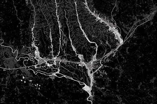
What is the future of the Veneto region in 2100, given the threats posed by rising sea levels, heavy rainfall, floods and drought? The Monti Lessini creeks form one of the three case studies of this project. They lie in between the ridges of Verona and Vicenza. They are cut by a corridor of heavy infrastructure and dense construction formed by the A4 highway, the railway, industrial activity and settlements. The danger linked to the creeks is well known: the area’s heavy rainfall and the steepness of its valleys make the creeks a constant threat, for they often overflow due to unmanageable amounts of rainwater and eroded sediment.
The scenario proposed here suggests creating north-south buffers along the creeks, that would make room both for the excess rainwater and for hosting basins, wetlands and woods. However the buffer differs local agriculture and reorientates the urban growth along the valleys, across the east-west corridor thereby gently restructuring this large region into a recreational territory.
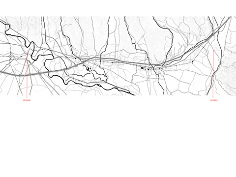
Design strategy for living with water in the Venice area
Analysis of the heavy infrastructure between Verona and Vicenza
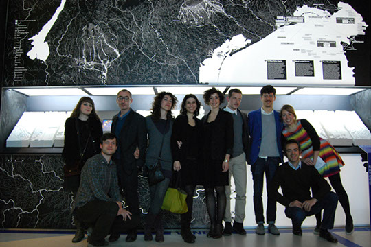
Exhibition of the project at the 5th IABR
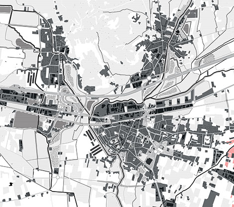
Design strategy for Monteforte
<
>
next >
Copyright 2011 Manoe Ruhe. All rights reserved. Last updated December 2014
